High Arctic Soil Science |
||
| The response of High Arctic ecosystems to global climate change requires that we have a better understanding of terrestrial organic carbon dynamics and distribution. To forecast the potential feedback of soil carbon in an anthropogenically warmed environment, it is important to have good estimates of the existing quantity and quality of carbon stores in the arctic. Various methods have been used toward this goal including; remote sensing, carbon dioxide flux measurements, soil pits and transects, biomass estimates, and others. While each has its merits, none has been able to confidently assess the total soil carbon (to the top of the permafrost) for the High (or Low) Arctic.
We are developing a multidisciplinary approach to more completely estimate soil organic carbon stores. This approach combines remote sensing, vegetation classification, soil science, geochemistry, correlation studies, and geomorphology in a multi-year research project at the Thule Air Base in
|
||
|
||
|
||
|
||

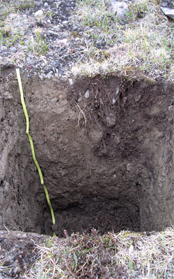
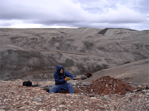
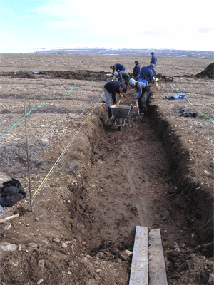
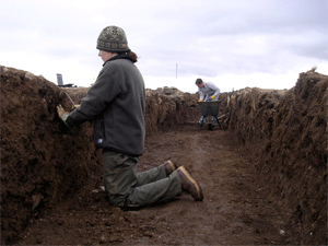
The pictures below are from a 16m long trench that was dug perpendicular to vegetated "stripes" on South Mountain. This provided an exciting opportunity for collaborative research on the formation of this patterned ground feature.
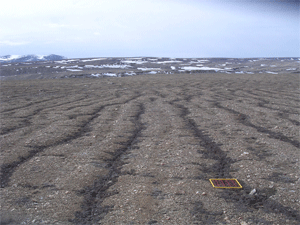
Stripe site on South Mountain prior to trenching.
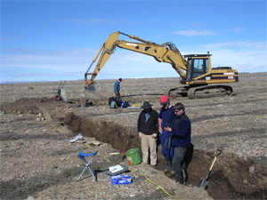
The 3 PIs examine the trench.
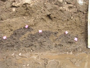
Right : Close up view of "wave" structures visible at the base of the trench.
Remote Sensing and Soil Carbon Mapping
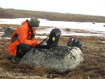
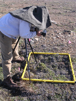
Left: Jennifer using a GPS device to locate pre-selected sites.
Right: Joe DeCant uses an NDVI camera to take pictures of satellite control plots.
ASTER map of the study site
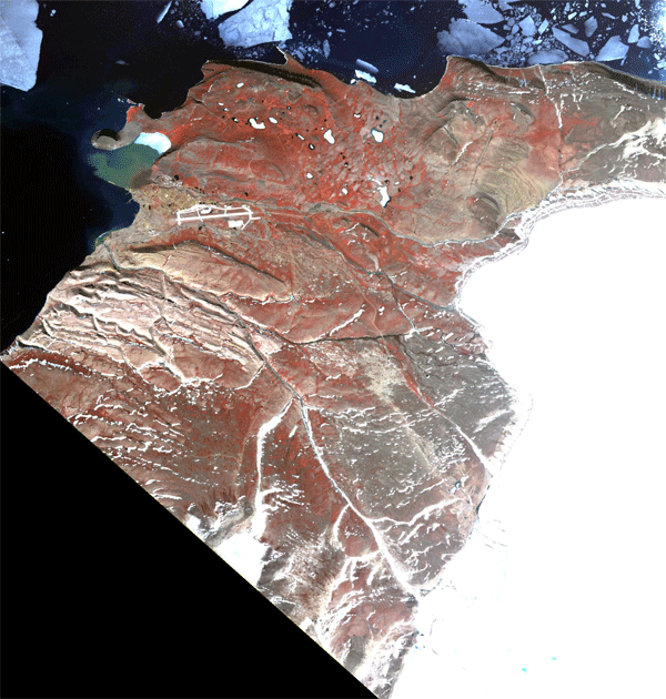
This is a slightly stretched ASTER image of our study site. It was captured on June 26, 2003. Reddish colors indicate the presence of vegetation. Interesting features to note are the air base (large white runway), the Greenland Ice Sheet on the far right hand side of the image, and the large sediment plume of the North River emptying into North Star Bay.
NDVI Map of the Thule Air Base region
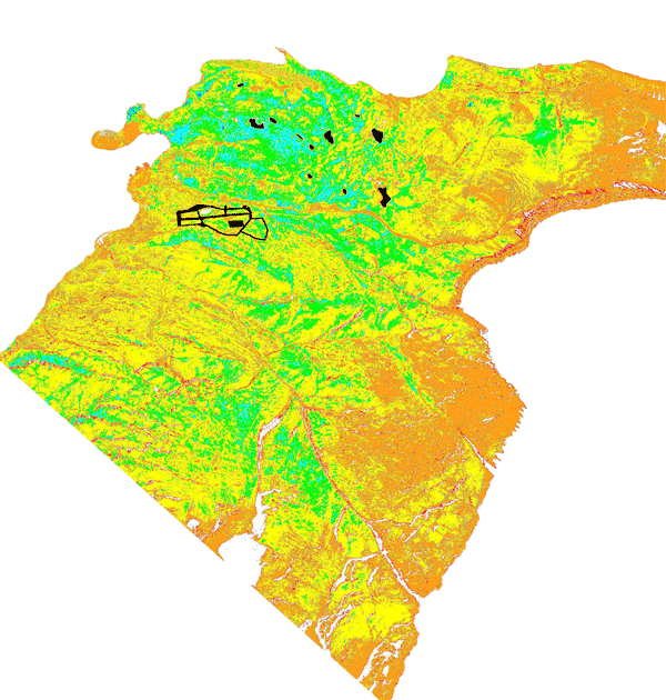
The colors of this map represent 7 classes of NDVI (normalized difference vegetation index) that were calculated from the above ASTER satellite map. The class boundaries or limits were borrowed from the CAVM (Circumpolar Arctic Vegetation Mapping) map (2003). Red and orange colors represent low NDVI values (thus less vegetative cover) and blue and purple colors represent the highest values. Black regions such as lakes and the runway are masked out in this map. This base map was one of the primary layers used to pre-select sites for the 2004 field season.
2004 Soil Sampling Sites
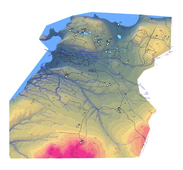
This map shows the locations of the 34 soil pits that were dug in the 2004 field season. As is fairly clear on the map, locations of sites were in somewhat close proximity to the extensive road network that eminates from the base. Other maps are available that show the location of sites in relation to bedrock geology, surficial geology, and mapped periglacial features.
Bedrock geology and 2004 soil sampling sites
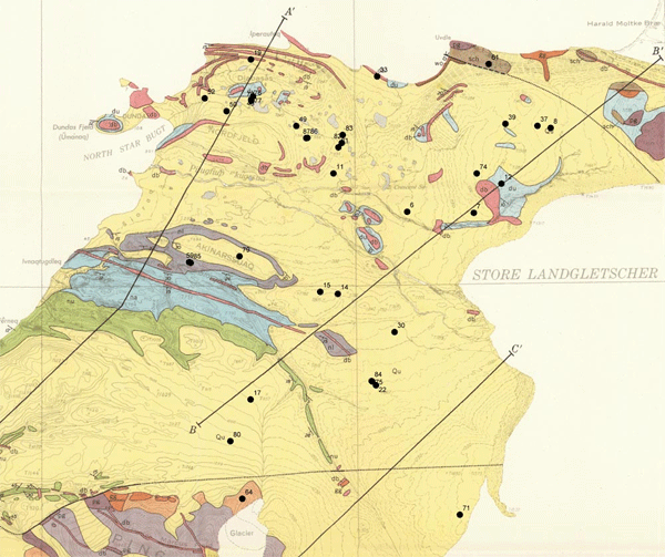
This map shows the location of the 34 pits and the underlying bedrock geology. Legend of colors is as follows: blue (du) = Dundas formation, yellow (Qu) = surficial Quaternary deposits, pink (db) = diabase, purple , blue , or green (nu, na, nl) = members of Narssassuk formation), brown (sch) = garnet-biotite and biotite-hornblende schist, and orange (gg) = gray banded gneiss. (base map source: Davies, et al., 1963)
Surficial geology and 2004 soil sampling sites
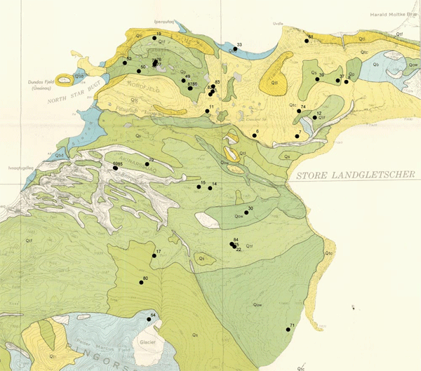
This map shows the location of the 34 pits and the surficial (Quaternary) geology. Legend is as follows: Qb = boulder field, Qtc = coarse till, Qtf = fine till, Qow = outwash and alluvium, Qbd = beach depositst, Qs = silt, Qp = peat deposits, and Qtl = talus deposits. (base map source: Davies et al., 1963)